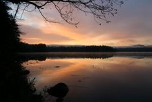
10 of us paddled about 7 miles on Kushaqua, not an easy thing to do given its relatively small size. But we did some back and forth looking for a good place for lunch. Another beautiful day, though it is finally getting a bit cool. I actually wore a jacket for much of the paddle.
Tuesday, August 23, 2011

Thursday, August 18, 2011
Paddling the Schroon River
We checked off another river on the Paddler's Pursuit today. We went with Al and Jini and planned to paddle the portion of the Schroon River north of Schroon Lake. But lots of signs at that put-in on Rt 74 just east of the northway made it sound as though you could only put in if you were fishing and the tone of the signs made us reluctant to leave a car there. So instead of doing a one-way trip, we drove to the south end of the lake and put in at a state boat launch there. We paddled about 3.5 miles downstream then turned around and paddled back. There were camps along much of the route and the noise from the highway made the trip less pleasant than it might have been. Quite sure we won't be going back.
Wednesday, August 17, 2011
Paddling Long Lake
We led a paddle of the southern portion of Long Lake today. We paddled about 9 miles from the put-in at the northern end of the carry around Buttermilk Falls up to have lunch on the beach by the bridge, and then back again. After the paddle we drove down the road a bit and walked in to Buttermilk Falls. We hadn't been there in years. There are even nice picnic tables nestled down in the rocks. We definitely need to go back.
We hadn't been there in years. There are even nice picnic tables nestled down in the rocks. We definitely need to go back.
Monday, August 15, 2011
Quilt
Just finished this quilt for the guest room here at camp. Now I have to make curtains to go with it.
Wednesday, August 10, 2011
Walking 'n Biking
We did so much driving Monday we stayed home yesterday and just walked the 3-mile loop on the road. This morning we walked to the dam and back. This afternoon when the forecasted rain did not materialize we drove the bikes to Fish Creek and did 2 loops, for a total of about 9 miles.
Monday, August 8, 2011
Paddling the Kunjamuk
Six of us had a nice paddle on the Kunjamuk River today. We launched off Route 30 at the "x" on the map at a put-in just past the parking area with picnic tables. We paddled across the bay and up the river to Elm Lake and back again for a total of about 8 miles. There were many beaver dams and W did a great job helping everyone and their boats over them on the way upstream. Then we got some good rides going over the dams on the way back. There were lots of things in bloom including pickerel weed,
 the neat buttonbush (Cephalanthus occidentalis in the Rubiaceae),
 and lots and lots of cardinal flowers.
We paddled across the bay and up the river to Elm Lake and back again for a total of about 8 miles. There were many beaver dams and W did a great job helping everyone and their boats over them on the way upstream. Then we got some good rides going over the dams on the way back. There were lots of things in bloom including pickerel weed,the neat buttonbush (Cephalanthus occidentalis in the Rubiaceae), and lots and lots of cardinal flowers.
Sunday, August 7, 2011


Friday, August 5, 2011
Paddling Taylor Pond
We paddled a new body of water today - Taylor Pond. It is on the Paddle Pursuit, which we're still sort of trying to complete. So it seemed like a good choice for yet another gorgeous, calm day.
 Though the pond seems small, we managed to paddle nearly 9 miles, so that was plenty. This view is courtesy of Google Earth and gives some idea of the surrounding mountains.
 Taylor Pond would be a great place to go at the height of fall colors. And if we take a group in, we'll have to remember that those of us 62 and over don't have to pay the day-use fee.
Though the pond seems small, we managed to paddle nearly 9 miles, so that was plenty. This view is courtesy of Google Earth and gives some idea of the surrounding mountains. Taylor Pond would be a great place to go at the height of fall colors. And if we take a group in, we'll have to remember that those of us 62 and over don't have to pay the day-use fee.
Thursday, August 4, 2011
Hiking 'n Biking
With the beautiful weather we have been having, we exercise outdoors most days. But I frequently don't blog about it; then we forget what we've done. So this is just a note to say that yesterday we hiked/walked about 4 miles along Bloomingdale Bog, going in from the southern end. We had hoped to find lots of blueberries, but didn't see many. Then today we drove the bikes to Fish Creek and did a couple of loops, adding up to about 12 miles. We had been biking around town but decided to brave the camping crowds today. And it wasn't bad. There really wasn't much traffic, so we'll probably do that again soon. The trick seems to be to go early afternoon when everyone is already wherever they intend to spend that part of the day. A little later, the new campers are coming in so the traffic picks up.
Tuesday, August 2, 2011
Paddling Quebec Brook
We led a 14-person paddle on Quebec Brook today. We drove in about 6 miles from Route 458 on a rough but passable road. Then we drove down a very narrow road used by the hunting camps all the way to the shore, marked by an "x" on the map, and put in there.
 We paddled up Quebec Brook to the end of the western branch and back again for a total of about 7.5 miles.
 I had hoped to explore Madawaska Pond as well, but the winds were very strong as we were coming back, so we were all very tired by the time we got back to the cars. Next time I'd like to park in the parking area on the road and carry the boats the mile to the put-in by the dam, marked with an "O" on the map. Then paddle around the pond and get out where we did today, carrying back up to the car. That should be doable with the light-weight boats and includes nice walks along with the paddle.
We drove in about 6 miles from Route 458 on a rough but passable road. Then we drove down a very narrow road used by the hunting camps all the way to the shore, marked by an "x" on the map, and put in there.We paddled up Quebec Brook to the end of the western branch and back again for a total of about 7.5 miles. I had hoped to explore Madawaska Pond as well, but the winds were very strong as we were coming back, so we were all very tired by the time we got back to the cars. Next time I'd like to park in the parking area on the road and carry the boats the mile to the put-in by the dam, marked with an "O" on the map. Then paddle around the pond and get out where we did today, carrying back up to the car. That should be doable with the light-weight boats and includes nice walks along with the paddle.
Subscribe to:
Posts (Atom)