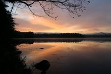
We led a 14-person paddle on Quebec Brook today.

We drove in about 6 miles from Route 458 on a rough but passable road. Then we drove down a very narrow road used by the hunting camps all the way to the shore, marked by an "x" on the map, and put in there.

We paddled up Quebec Brook to the end of the western branch and back again for a total of about 7.5 miles.

I had hoped to explore Madawaska Pond as well, but the winds were very strong as we were coming back, so we were all very tired by the time we got back to the cars. Next time I'd like to park in the parking area on the road and carry the boats the mile to the put-in by the dam, marked with an "O" on the map. Then paddle around the pond and get out where we did today, carrying back up to the car. That should be doable with the light-weight boats and includes nice walks along with the paddle.
 We drove in about 6 miles from Route 458 on a rough but passable road. Then we drove down a very narrow road used by the hunting camps all the way to the shore, marked by an "x" on the map, and put in there.
 We paddled up Quebec Brook to the end of the western branch and back again for a total of about 7.5 miles.
 I had hoped to explore Madawaska Pond as well, but the winds were very strong as we were coming back, so we were all very tired by the time we got back to the cars. Next time I'd like to park in the parking area on the road and carry the boats the mile to the put-in by the dam, marked with an "O" on the map. Then paddle around the pond and get out where we did today, carrying back up to the car. That should be doable with the light-weight boats and includes nice walks along with the paddle.

No comments:
Post a Comment